\".")

Manipulated Maps
FOR USE AS ARTWORK PLEASE CONTACT - CUSTOM DESIGNS CAN BE ARRANGED
I've long felt there is a kind of aesthetic intrigue and beauty in maps. Whether they be satellite Google earth style images, drone-to-satellite overview photos, or simple road-maps and ordnance surveys–I find myself staring at maps often, and this has been the case since i was very young. Seeing maps gives you a different sense of a location and there is a lot of enjoyment in this perspective shift. Looking at your childhood town, for instance, and marvelling at how small it all looks, can be an interesting experience.
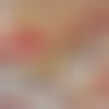
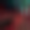
With this collection, I bought myself a map of the city I currently live in (Brighton & Hove), the town of my upbringing (Croxley Green), as well as a map of a place that I hold dear to my heart and lived at for a year (Pacific Northwest), and used these as a basis to manipulate them in any way I liked. The resulting images ranged from abstract forms that hardly resembled the original maps, to ones where the shape, or perhaps simply just the names, of the area were somewhat recognisable. Doing this both reflects how maps are simultaneously accurate yet abstract. A map might have become part of our daily lives, its shapes or colours internalised and recognisable in the mind, yet still they are abstract creations. This method of manipulating maps transports my conceived beauty of the form of maps into more obvious depictions.
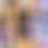
You can find more of this collection at https://williamv1303.myportfo… . This project is ongoing and I hope to collect more maps of the places that are important to me, such as my birth-city of Boston (which I've never visited since leaving as an infant). Commissions for custom designs are available. I have attatched a few examples of how these may look with words on them as EP/single/album covers but these are all open to interpretation and further ideas.


 \".")


\".")
\".")

\".")
\".")